|
More News: |
|
- ► Oct 30, 2009:Try our new Survey and Poll tools on the Feedback page.
- ► Oct 27, 2009: the "National Land Remote Sensing Outreach Act" (version 2 of the AmericaView Geospatial Imagery Mapping Program Act). H.R.2489 passed on the House floor with a Roll-Call vote of 379-33. Six of eight Wisconsin reps voted for AmericaView! Thank you Reps. Baldwin, Kagen, Kind, Moore, Obey, and Ryan!
- ► Sept 30, 2009: "AmericaView Geospatial Imagery Mapping Program Act." H.R.2489 passed in the House Natural Resources committee today by unanimous consent.
- ► August 5, 2009: "AmericaView Geospatial Imagery Mapping Program Act." S.1078 passed in the Senate Committee on Science, Commerce, and Transportation today by unanimous voice vote, with an amendment.
- ► July 21, 2009: WisconsinView Director, Sam Batzli is part of a 4-person panel that will testify before congress Thursday July 23rd regarding H.R.2489 the "AmericaView Geospatial Imagery Mapping Program Act."
- ► July 1, 2009: In an effort to improve access and eliminate barriers, WisconsinView has registered all of its public domain imagery with a Creative Commons "CC-Zero" waiver.
- ► June 26, 2009: WisconsinView logged its 8,000 registered data user at 3:30pm today.
- ► June 25, 2009: We welcome the Wisconsin Department of Military Affairs (DMA) to the WisconsinView Consortium! Wisconsin Emergency Management is operated under the DMA and so WEM is also now part of the Consortium.
- ► June 22, 2009: We welcome the Wisconsin State Geographic Information Office (GIO) to the WisconsinView Consortium!
- ► May 27, 2009: UW-Madison faculty and staff are now eligible for an 85% discount on SPOT satellite imagery for one year. For more info about the AmericaView-SPOT program visit the website or contact Dr. Sam Batzli.
- ► May 19, 2009: AmericaView Authorization Act introduced in both the House (H.R.2489) and Senate (S.1078). This Act, if passed would help stabilize the long-term future of WisconsinView.
- ► March 17, 2009: Wisconsin Transverse Mercator (WTM) versions of 2008 NAIP county mosaics in MrSID format are now online here (courtesy of the WI DNR).
- ► March 16, 2009: Governor Jim Doyle launches Flood Safety Awareness Week in Wisconsin. Presentations around the state will use WisconsinView-supplied data and maps.
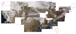
- ► March 5, 2009: Daily MODIS Imagery now available for 33 AmericaView states in both true and false color composites. more....
- ► Feb 20, 2009: WisconsinView, Batzli awarded a 2009 Friend of Land Records Award from the Wisconsin Land Information Association (WLIA). more....
- ► Feb 19, 2009: New WisconsinView website is now online. Please use the contact link on the left to voice any comments or concerns. Thanks!
- ► Feb 19, 2009: WisconsinView logged its 7,500 registered user today at 08:58:30.51. See our GoogleMap of new users to see what kinds people visit our site and from where.
- ► Jan 26, 2009: New MOU with SPOT Image provides academic partners of AmericaView access to SPOT imagery at 85% off regular prices. Visit the SPOT AV website for details. Contact WisconsinView director for access instructions.
|
|
|
|